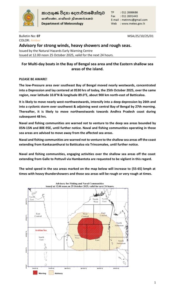
The Department of Meteorology has issued an advisory for strong winds, heavy showers and rough seas for multi-day boats in the Bay of Bengal sea area and the Eastern shallow sea areas of the island, valid for the next 24 hours starting at 12.00 pm today.
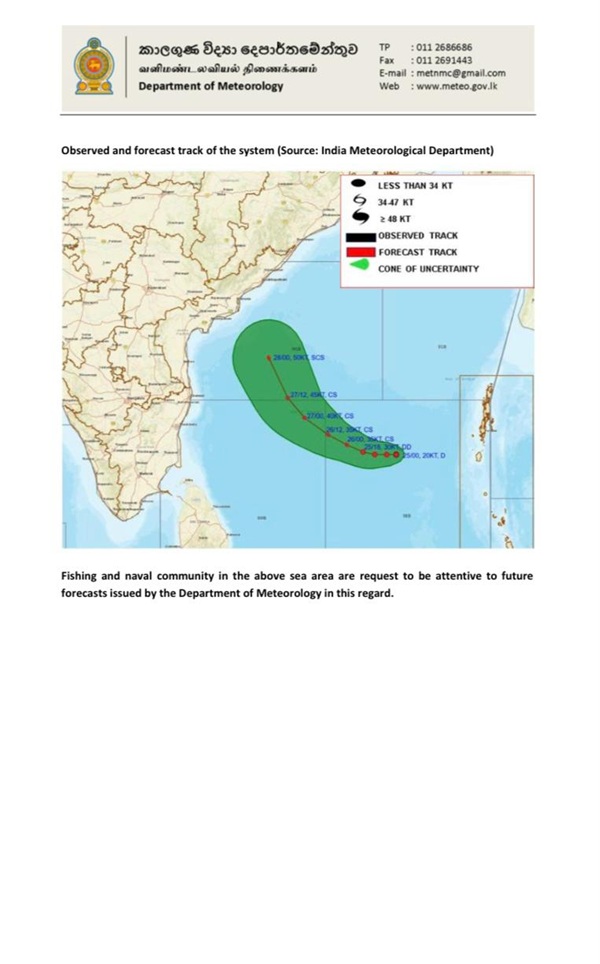
According to the Department, the low-pressure area over the southeast Bay of Bengal, which has moved nearly westwards, has concentrated into a Depression and lies centred at 0530 hrs of today (25), over the same region, near latitude 10.8°N & longitude 89.0°E, about 900 km north-east of Batticaloa.
It is likely to move nearly west-northwestwards, intensify into a deep depression by tomorrow (26) and into a cyclonic storm over the southwest and adjoining west central Bay of Bengal by Sunday morning (27). Thereafter, it is likely to move northwestwards towards the Andhra Pradesh coast during the subsequent 48 hrs.
The Naval and fishing communities are warned not to venture into the deep-sea areas bounded by 05N-15N and 80E-95E, until further notice. The Naval and fishing communities operating in those sea areas are advised to move away from the affected sea areas.
The Naval and fishing communities are also warned not to venture into the shallow sea areas off the coast extending from Kankasanthurai to Batticaloa via Trincomalee, until further notice. The Naval and fishing communities, engaging in activities over the shallow sea areas off the coast extending from Galle to Pottuvil via Hambantota, are requested to be vigilant in this regard.
The wind speed in the sea areas marked on the map below will increase to 55-65 kmph at times with heavy thundershowers, and those sea areas will be rough or very rough at times. (Newswire)