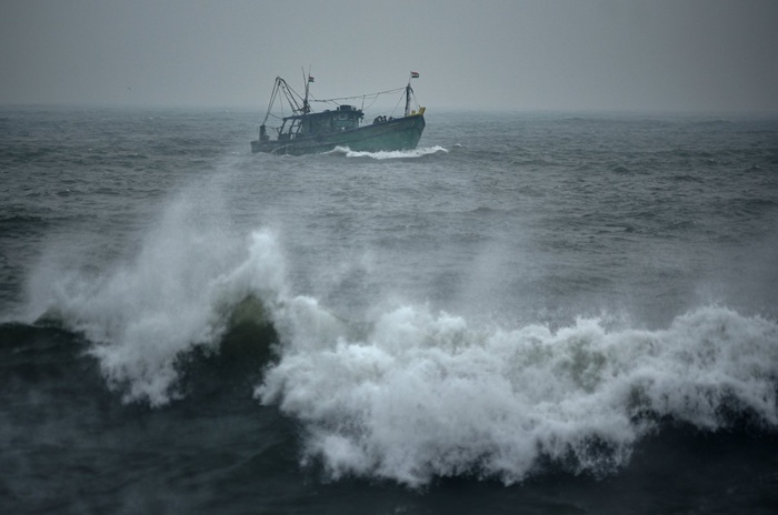
The Naval and fishing communities are warned not to venture into the deep and shallow sea areas around Sri Lanka from today (08 Jan) until further notice, due to the depression over the Bay of Bengal.
According to the Met Department, the depression over the Bay of Bengal, located southeast of Sri Lanka, was centered about 490 km southeast of Pottuvil, at 11:30 pm yesterday and is expected to move west-northwestwards and towards the eastern coast of the island during the next 24 hours. This system is likely to intensify further into a deep depression during the next 12 hours.
As such, showers or thundershowers will occur at several places in the sea areas off the coast extending from Mannar to Galle via Kankasanthurai, Trincomalee and Pottuvil today. Showers or thundershowers may occur at several places in the other sea areas around the island in the evening or night.
Winds will be north-easterly and wind speed will be 35-45 kmph. Wind speed can increase up to 60-70 kmph at times in the sea areas around the island.
The sea areas around the island will be rough to very rough at times. The wave height may increase about 2.5 – 3.5 m in the sea areas off the coast extending from Kankasanthurai to Hambantota via Trincomalee and Pottuvil (this is not for land area). Temporarily strong gusty winds and very rough seas can be expected during thunderstorms. (Newswire)