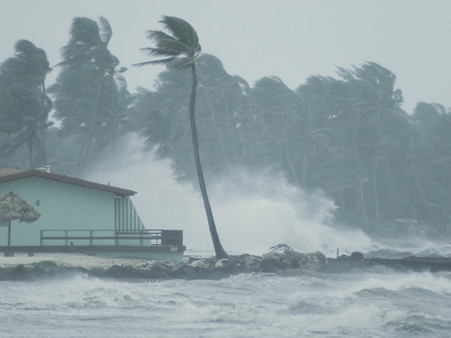
The deep depression over the southeast Bay of Bengal remains a deep depression and is very likely to move north-northwestwards, the Department of Meteorology stated.
The department said that it will intensify into a cyclonic storm over the southeast Bay of Bengal and then into a severe cyclonic storm over the central Bay of Bengal.
The Naval and multi-day fishing communities are advised not to venture into the sea areas bounded by 03N – 20N and between 85E – 100E until further notice.
Naval and fishing communities are requested to be vigilant while engaging in naval and fishing activities in the sea areas off the coast extending from Galle to Pottuvil via Matara and Hambantota and in the sea areas off the coast extending from Chilaw to Trincomalee via Puttalam, Mannar, Kankasanthurai and Mullaitivu.
The department stated that showers or thundershowers will sometimes occur in the sea areas around the island.
Winds will be south-westerly over the sea area around the island and the speed will be 30-40 kmph.
Wind speed may increase up to 50-55 kmph in the sea areas off the coast extending from Galle to Pottuvil via Matara and Hambantota and in the sea areas off the coast extending from Chilaw to Trincomalee via Puttalam, Mannar, Kankasanthurai and Mullaitivu.
The sea areas off the coast extending from Galle to Pottuvil via Matara and Hambantota and sea areas off the coast extending from Chilaw to Trincomalee via Puttalam, Mannar, Kankasanthurai and Mullaitivu will be rough. The other sea areas around the island will be fairly rough.
Temporarily strong gusty winds and very rough seas can be expected during thundershowers. (NewsWire)